Shawdog's Mountain House
Thanks for the Memories!
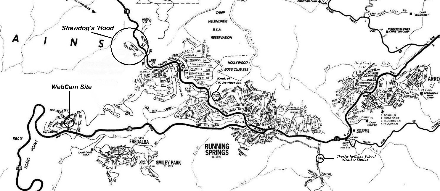
Running Springs, CA  

Elevation 6020'   Latitude 34° 13' 04"N    Longitude 117° 07' 51"W

UTM Coordinates  11 487860E 3786310N

Running Springs Current-Conditions Webcam

 
Click On Any Thumbnail Picture Below For A Full-Screen Image
(Image Will Be Shown in a New Browser Window)
 
Driveway and Roof Seen From Street In Mid-January (32)
Deck Looking South
Deck Looking Southwest in Winter
Upslope View In Early April
View Looking South in Winter (21)
Winter View From Dining Room West Toward Mt. Baldy
Deck Looking Northwest After An April Snowfall (27)
The Fastest Snow Plow On Earth!
Living Room Seen From Deck At Night
Dining Room South Wall
Dining Room North Wall On A Winter Afternoon (22)
Kitchen (19)
Dining Room & Kitchen Seen From Living Room In Spring (04)
Living Room South Wall In Winter (15)
         Living Room NE Corner (07)
Bedroom North Wall (17)
Bedroom South Wall In Winter
Bedroom East Wall (03)
Bathroom
Night View Looking West Toward Los Angeles
Living Room Southwest Corner (30)
Floorplan   Architectural Overview   ACSC Detail Map

For  Road Conditions, Click On Any Highway Shield Below:
Interstate 10 (Santa Monica/San Bernardino Freeway)    Interstate 605 (San Gabriel River Freeway)      California 18 (Rim Of The World Highway)     California 60 (Pomona Freeway)     California 330 (City Creek Canyon Road)
Comments? shawdog@earthlink.net

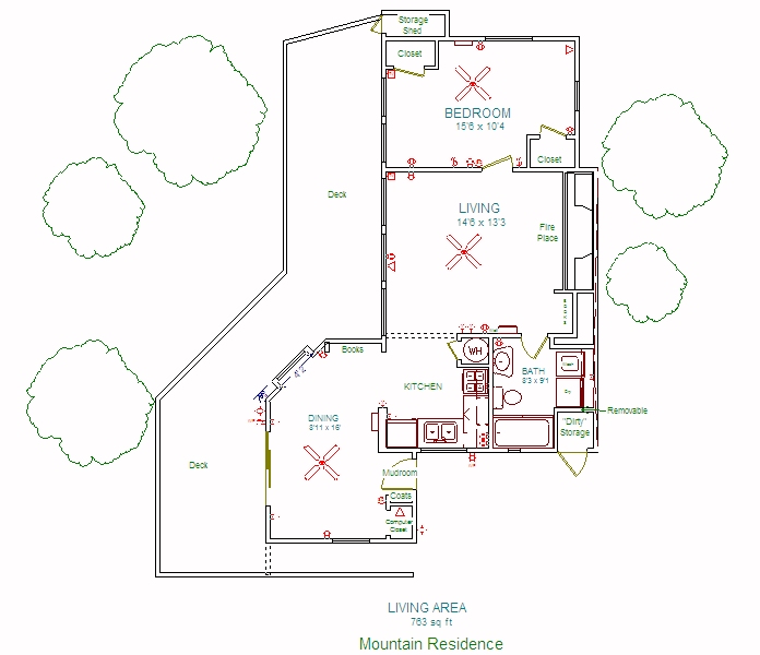
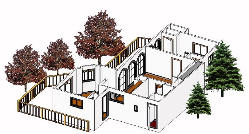
Shawdog's Mountain Place Has Been Sold!

Looking for a Mountain Home of Your Own?  Contact  My Realtor: cblassak@aol.com

Last Update: May 7, 2006

This Webpage Has Been Tested with Internet Explorer 6.0 and Netscape 7.0
It May Not Function Correctly With Earlier Browsers

© Copyright 2002-2006 - All Rights Reserved